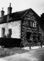
Bure
Cottage c.1950
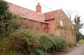
Bure
Cottage December 2001
| Itteringham.com |
Although
the boundary between Itteringham village and Itteringham Common is the River
Bure, the hamlet that makes up the Common as it is known, lies about half
a mile south east of the main village. The Walpole Arms, Hill Farm and the
Mill Cottage are all technically part of the Common with the Mill lying
between the two. |
The Common was originally an area of communal land where villagers could graze their animals and collect firings and kindling. The local 1818 Enclosure act was completed in 1823 and saw a new straight road made across the last remaining common. The villagers were each allotted small areas of the old common and waste, which then became part of their property on which to grow vegetables or keep a few animals. Several of the cottages on the common date from shortly after 1823 when some of these allotments were sold to a developer, John Randall. |
|
|
|
Bure
Cottage c.1950
|
Bure
Cottage December 2001 |
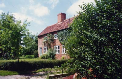
Bure
Cottage was originally built in 1792, with a thatched roof. A second cottage
was attached a few years later in 1796. As with many similar houses, a catslide
extension was added in the late 19th century.
There are more flint buildings
on the Common than in the village itself. |
 |
|
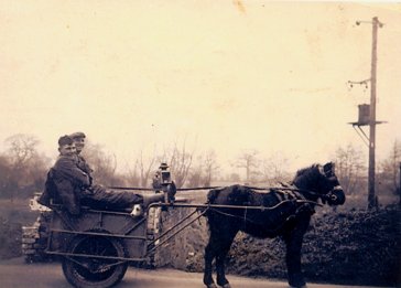
Medo
(Fred Baxter) and Ivan Thompson sitting in Medo's cart next to the pulk
on the Common in the '60s
|
 |
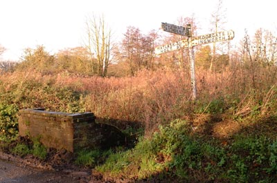 |
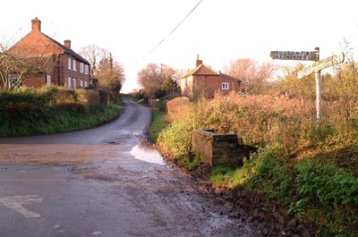
The pulk and the signpost both in need of repair 8th December 2001 |
|
The
pulk was a public water collection point for many years and was fed by a
fresh water spring. Access to the bucket filling area was on the north (far)
side. It was used until the late 60s when a water main was finally laid through the village. |
In the late 1970s Perran Penrose, then living locally but since deceased, made repairs to the ailing pulk wall using a bricklaying pattern rarely found in Norfolk. The pulk is now only occasionally cleared and the water is not used locally; its quality probably reflects the intensive use of agricultural chemicals on surrounding fields |
|
Pulk 1. A hole
full of mud or a small muddy pond otherwise a pulk-hole |
Being at the bottom of the hill, the
pulk flooded regularly and went green in the summer so we had to throw it
out... I reckon it was about 5 foot deep... all the Common used it except
for Austin who had their own well. Harry Broughton had a well but it was
not working. I used to carry buckets for the old ladies on the common...
for a few pence. We were still bucketting out of the pulk when I came out
of the army in 1957... there was no mains water, never had a modern toilet
or anything like that... you took a bucket and chucked it down the toilet! Ivan Thompson |
 |
|
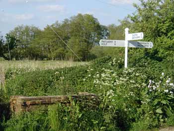
The
new signpost 18th May 2004
|
 |
 |
|
|
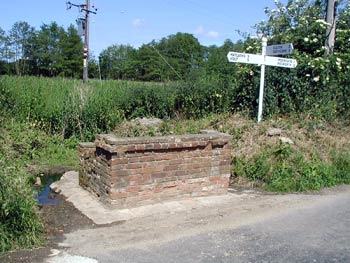
Area
cleaned up by the National Trust 12th June 2004
|
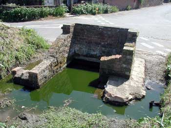
Interior
awaiting drain clearance 12th June 2004
|
|
The
shop on the Common closed some years back. Towards the end it was only selling such items as sweets and tobacco. |
 |
|
The
old shop on the Common c.1990
|
| Sometimes she would throw the sweets
at you... Austin Fowell |
My father is from Itteringham, and until I left Norfolk for university in 1991 we visited my grandmother (the late Edith
Broughton - infamous sweet-throwing shopkeeper!) weekly at 86 The
Common. Sadly my grandfather died before my birth and as Dad was the
youngest of his children my knowledge of the extended side of his
family has always been sketchy. To see for the first time pictures of
Broughton lads tearing round the cycle speedway circuit amuses me no
end, and as I zip to work through the traffic on Monday morning I'll
feel more at home in my toe-clips than ever! Jim Broughton - 3rd March 2006 |
|
Long
demolished, there were also some cottages known as the Town House(s),
which the parish used for poor people before the advent of parish unions
that provided for the poor by building the infamous workhouses. The Town
House stood near the road in front of what is now Orchard Farm. The overseers
accounts of the 1740s regularly show bills for re thatching, glazed windows,
bricks for rebuilding and "dawbing the Town house". In 1839
the Town House appeared as plot no. 102 on the tithe map and the records
show that the occupants were John Harrison, Thomas and Elizabeth Riscberry,
William? Smith, Joshua Ayton and William? Sparrow. |
 |
 |
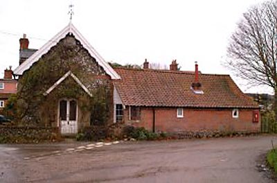
The Wesleyan Methodist Chapel December 2001 |
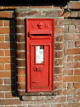
The Victorian postbox on the wall next to the chapel |
| If you have any memories, anecdotes or photos please let us know and we may be able to use them to update the site. By all means telephone 07836 675369 or |
Copyright © Jonathan Neville 2004 |